[/et_pb_dp_dmb_module_508]
The Lake of the Woods boasts over 14,500 islands and more than 105,000 kilometers of shoreline. It occupies parts of Ontario, Manitoba and Minnesota. It is a lake of intriguing variety, with islands, bays and channels in the north half, and wide open expanses and sandy shores in the south.
Since the earliest inhabitants hunted, fished, and gathered food in this area, they navigated these waters using canoes. Later European settlers employed York boats, steamboats, sailing vessels, and motor launches to make their way through the channels and bays.
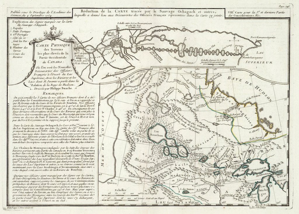
The earliest known maps of the lake date to the 1700s when the French pushed into the wilds of northwestern Ontario in search of the Western Sea. Since then explorers, surveyors, cartographers, hydrographers, and lake residents have tried to accurately depict the wonder of the lake in the two-dimensional format of a map.
Here we present a selection of maps of our Lake.
Did you know?
Walter J. Phillips visited Lake of the Woods in the summers of the 1910s -1920s. This distinctive landscape would serve as inspiration until 1940.